However, visiting The Wave is not done easily. Due to its popularity, and the fragile nature of the sandstone (which visitors hike directly upon) the Bureau of Land Management requires visitors to obtain permits in advance. 20 permits are issued for each day - 10 of these are issued online several weeks in advance, and the other 10 are set aside as "walk-in" permits issued the day before your desired trip. All of the permits are issued based on a lottery system, rather than "first come, first serve," so obtaining a permit is simply the luck of the draw. For more information, refer to the BLM's website HERE.
To give you an idea of the likelihood of obtaining a Wave permit, especially if your dates aren't flexible: it took me 4 or 5 attempts to obtain a walk-in permit before I finally succeeded, and these attempts were all during the "slow" season. During the summer months, your odds decrease significantly. Luckily for me, I lived in Kanab (where they do the walk-in lottery) so I didn't have a high sense of urgency to obtain a permit during a specific day.
For those who are unable to obtain a Wave permits: DO NOT BE DISCOURAGED! The Wave is just one of many options you have to explore in the area. Don't let its popularity fool you, there is other stuff that is just as good, if not better than The Wave. Ask a ranger in the Kanab BLM visitor center and they'll be more than happy to direct you to a viable alternative to The Wave.
One more important point I'd like to make before describing my hike to The Wave - for those lucky enough to obtain a permit: This is not your "average" 5.5 mile hike. Most of the hike is off trail, with little to no shade. The BLM will hand out a trail guide with pictures of landmarks to help guide you along the way. Make sure you bring this on your hike. Without it, even the most advanced hikers could lose their way, especially if it's their first time to The Wave. Bring plenty of water, especially in the summer - more than you think you'll need. Most importantly, don't do anything that you feel is beyond your comfort/ability level. Normally, I'm not one to try and scare people away, but last July (2013) alone, 3 hikers died while attempting The Wave, and all cases were completely avoidable had they been better prepared, and had a better idea of their abilities.
Thanks for listening to my shpeel. Now, on to the fun stuff!
I was pretty excited when I finally scored a Wave permit, especially after one of my failed attempts when the odds were considerably in my favor (14 people for 10 permits) and Stephany and I were 2 of the 4 left out. Ouch.
The Wave shares a trailhead with Wire Pass up the House Rock Valley Road, but the trail splits out of the wash, where there is an obvious sign. Make sure you have a permit!
 For a while, there is an obvious trail, but soon, you begin hiking across slickrock with no trail or rock cairns to guide you. I can't over-empasize how helpful the BLM's handout is in helping you find your way.
We chose a sunny but chilly December day (in 2011) to complete the hike. Overall, the hiking weather was perfect, and it's nice not having to worry about the blistering summer heat. If at all possible, I highly recommend hiking The Wave during the "slow season."
Despite all of my warnings about preparing to hike The Wave, if you're an advanced hiker, chances are you won't find the hike to be overly difficult. It's truly amongst the most fascinating marvels that nature has to offer.
During my hike, I didn't take many photos along the way, but once I arrived at The Wave, I had a tough time putting my camera down.



For those who are unable to obtain a Wave permits: DO NOT BE DISCOURAGED! The Wave is just one of many options you have to explore in the area. Don't let its popularity fool you, there is other stuff that is just as good, if not better than The Wave. Ask a ranger in the Kanab BLM visitor center and they'll be more than happy to direct you to a viable alternative to The Wave.
One more important point I'd like to make before describing my hike to The Wave - for those lucky enough to obtain a permit: This is not your "average" 5.5 mile hike. Most of the hike is off trail, with little to no shade. The BLM will hand out a trail guide with pictures of landmarks to help guide you along the way. Make sure you bring this on your hike. Without it, even the most advanced hikers could lose their way, especially if it's their first time to The Wave. Bring plenty of water, especially in the summer - more than you think you'll need. Most importantly, don't do anything that you feel is beyond your comfort/ability level. Normally, I'm not one to try and scare people away, but last July (2013) alone, 3 hikers died while attempting The Wave, and all cases were completely avoidable had they been better prepared, and had a better idea of their abilities.
Thanks for listening to my shpeel. Now, on to the fun stuff!
I was pretty excited when I finally scored a Wave permit, especially after one of my failed attempts when the odds were considerably in my favor (14 people for 10 permits) and Stephany and I were 2 of the 4 left out. Ouch.
The Wave shares a trailhead with Wire Pass up the House Rock Valley Road, but the trail splits out of the wash, where there is an obvious sign. Make sure you have a permit!
We chose a sunny but chilly December day (in 2011) to complete the hike. Overall, the hiking weather was perfect, and it's nice not having to worry about the blistering summer heat. If at all possible, I highly recommend hiking The Wave during the "slow season."
Despite all of my warnings about preparing to hike The Wave, if you're an advanced hiker, chances are you won't find the hike to be overly difficult. It's truly amongst the most fascinating marvels that nature has to offer.
During my hike, I didn't take many photos along the way, but once I arrived at The Wave, I had a tough time putting my camera down.
Warning: tons of pics to follow!
(Yes, dogs are allowed at The Wave!)
Doing The Wave Dance!

(Actually, it's my dance for all things awesome.)

We scrambled up to a high point to catch some views of the surrounding area.


Obviously, a trip to The Wave is about way more than The Wave itself.
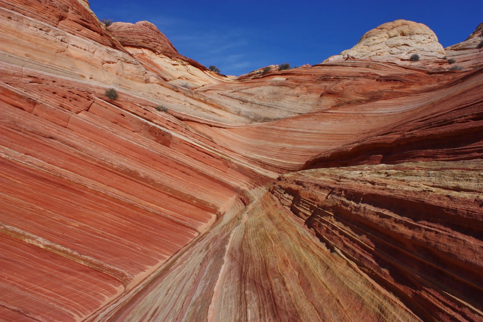
Back to the streaky stuff!

Perhaps my personal favorite:


Wave Cave (or cavern, or whatever...)


Making our way back:

Sorry if that photo overload was a bit excessive, but I think it was necessary!
Continuing back to the trailhead left us with a feeling of complete satisfaction. One day I hope to return to The Wave but if I don't, it's okay, because I know I'll never forget it.
If you are fortunate enough to get a Wave permit, I am sure you will be thoroughly satisfied with your experience, as I was. If you are unable to obtain one: I can almost guarantee that you will also be thoroughly satisfied by one of the countless other options the area has to offer.
If you are fortunate enough to get a Wave permit, I am sure you will be thoroughly satisfied with your experience, as I was. If you are unable to obtain one: I can almost guarantee that you will also be thoroughly satisfied by one of the countless other options the area has to offer.


