Luckily, the Juneau area is situated barely above sea level. The nearby Pacific Ocean, combined with its position in far Southeastern Alaska make the climate much milder than most of the state. Juneau is considered to be a temperate rainforest and gets precipitation year round (including quite a bit of snow in the winter), but by the time I arrived, the lower country was entirely snow free. This made it a good time to explore these areas while waiting for the mountain snow to melt.
The Herbert Glacier is fed from the Juneau Icefield - a massive area of ice larger than the state of Rhode Island! Of the 38 glaciers that the icefield feeds, is it probably the second most easily accessed (after the Mendenhall, where I worked).
 The Herbert Glacier Trail is accessed between mile markers 26 and 27 on the Glacier Highway, which runs northwest from Auke Bay. This section of highway is commonly referred to as "out the road" by Juneauites.
I ventured out with a couple of roommates/co-workers who also had the day off. The hike started on a flat, well-maintained trail that meandered through old growth forest. Like most glaciers in Alaska, the Herbert is receding. As we got closer to the glacier, the vegetation began to change, and newer growth became more prominent. This was revealing an area that was ice-covered much more recently than where the trail started.
After about 5 miles, the trail led us to the Herbert River, with our first view of the glacier beyond.

This was basically the end of the trail, but we kept going, trying to get as close the glacier as we could. After making a couple of shallow river crossings, a very deep, roaring section was a major barrier between us and the glacier. We were still close enough to get some impressive glacier views, though.

We hiked up a side drainage which required a bit of hand-over-hand scrambling. It was well worth our efforts and offered a different perspective of the glacier:
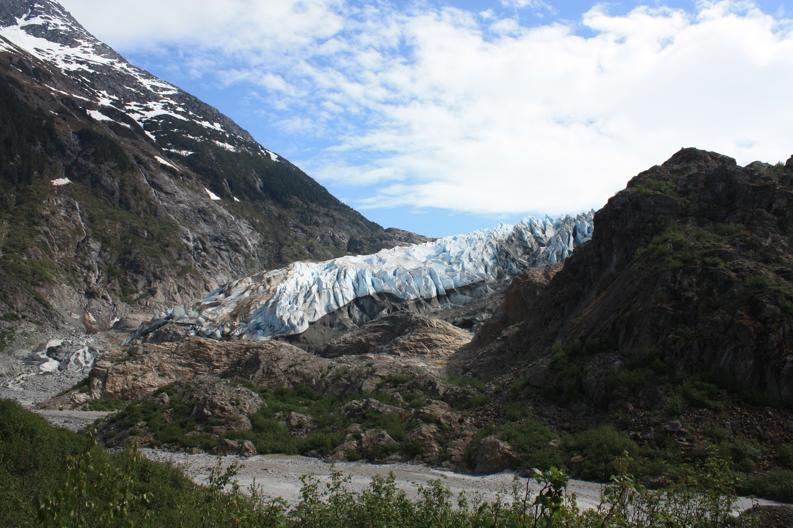

The terminus of the glacier appeared almost liquid...as if you could mold it into shape. I could barely wrap my head around such a spectacle!
 Unnamed peak near Herbert Glacier:
After a lunch break, we turned around and headed back down the trail, the way we came, again noticing the vegetation changes in reverse order.

As we reached the trailhead, I noticed that despite the 10+ miles we logged, I barely drank any water. I had taken no more than a few sips from one of my Nalgene bottles, and the other I hadn't even touched. It was an easy 10 miles with minimal elevation change. Still, I was used to the desert of Southern Utah where feeling thirsty is pretty much "the norm," regardless of what you're doing. I remember thinking I could get used to the damp Southeast Alaska air.
It was great intruductory hike to the Juneau area before tackling some of the mountains, and one that I'd recommend to anyone.
No comments:
Post a Comment